

Showing posts with label USA. Show all posts
Showing posts with label USA. Show all posts
Monday, September 3, 2018
Foxtail in Late Summer


Wednesday, July 4, 2018

Wednesday, June 20, 2018
Wednesday, August 23, 2017
Eclipse over Fairmont, Nebraska
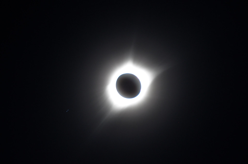
A total solar eclipse is something to behold. I have seen partial solar eclipses and thought highly of them, especially if the foreground had some interesting objects or the sun's surface had sunspots. This was my first visit to the zone of totality. It brought me to Fairmont, Nebraska where about 5,000 other eclipse enthusiasts gathered on Monday, August 21 to view the event.
The morning leading up to the eclipse was filled with clouds from a passing thunderstorm with periods of open blue skies. At totality the sky near the sun was mostly cloud free, which only accented the most wondrous sky event that I have witnessed.
Photos, films and video cannot do the totality event justice because of all the rapidly changing sky conditions, the crowd's reaction, and the grandeur of the what is being witnessed. To see the solar corona develop as the moon completely covers the sun is spectacularly unforgettable.
Do yourself a favor and make plans to see a total solar eclipse in person. For the US, that would be on April 8, 2024. I still have more photos of this event that I will post soon - more of what was happening with the crowds.
Sunday, September 6, 2015
A Towboat Captain's Detailed Map of the Lower Mississippi River near Rodney Island
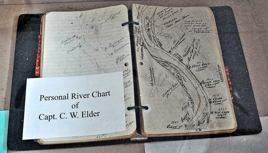
In the days before easily updatable mapping software, towboat captains on the Mississippi River detailed sections of the river in their log books by hand drawings. Captain C.W. Elder's map book can be seen at the George M. Verity River Museum in Keokuk, Iowa. The 1920's towboat was decommissioned and sold to the city of Keokuk in 1961 for the purpose of educating generations about towboats on the river.
This map appears to show the hazards of the water along a stretch of river between Mississippi and Louisiana, just north of Natchez, MS. South is to the top of the map. Rodney Island is the key to trace this hand drawn waterway illustration to modern maps like Google Maps. Discover for yourself.
Monday, August 31, 2015
Chief Keokuk Oversees the Mississippi River
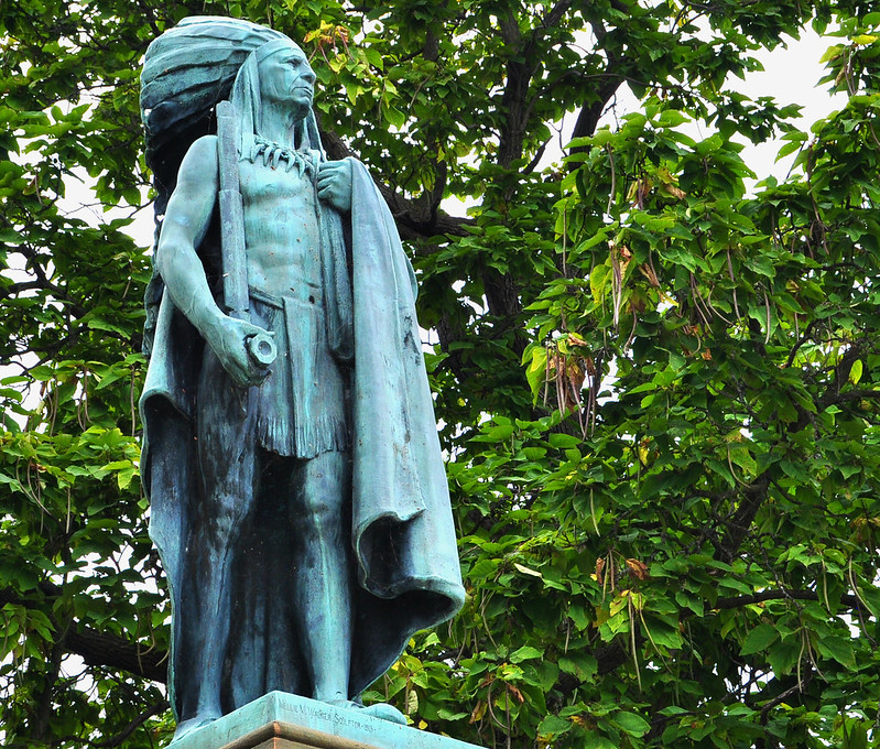
Atop a limestone bluff overlooking the Mississippi River in southeast Iowa is the gateway city called Keokuk, named after the region’s Sac and Fox warrior chief. He died during 1848 in Kansas. The Chief's remains and "other materials of historic value" were reinterred at the base of this moment in the city named in his honor. The town is one of Iowa's oldest communities as explorers coming up the Mississippi stopped at the confluence of the Des Moines and Mississippi Rivers to settle. Later the town became one of the jumping off points for pioneers setting out on the Mormon trail to Salt Lake. Its a very historic town that brims with the sights of the past.
Sunday, June 14, 2015
Flag Day 2015 from Iowa

Happy Flag Day 2015 from two locations in 42N country's Iowa. This flag site is from St. John's cemetery in Lisbon, Iowa. The cemetery road is lined with many, many of these flags which are flown on special occasions.

These U.S. and POW flags are located at the Iowa Veterans Home in Marshalltown, Iowa. There is a giant U.S. flag, like you see at Perkins Restaurants, across the road from these flags but it doesn't have the POW component.
Subscribe to:
Posts (Atom)