
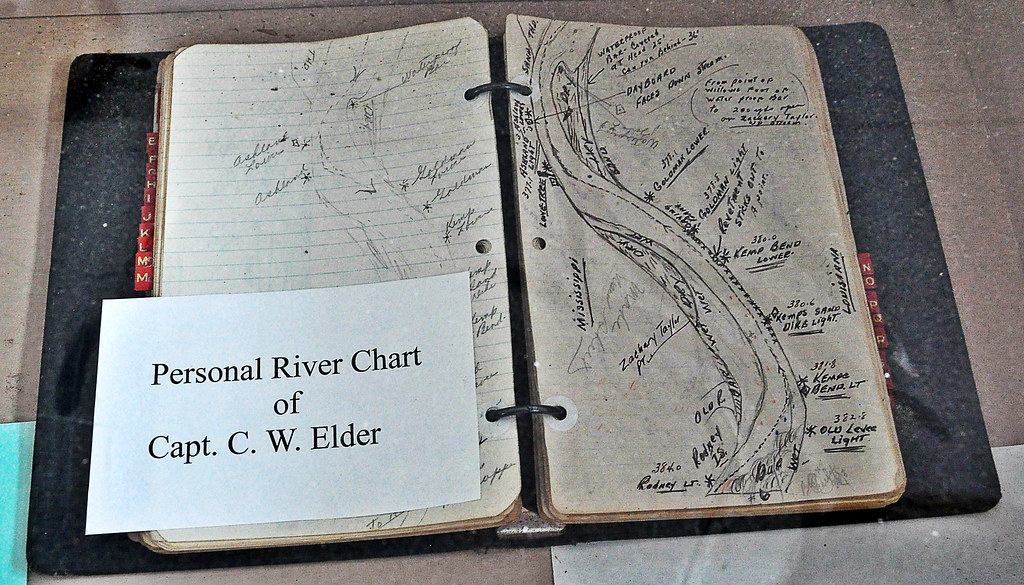
In the days before easily updatable mapping software, towboat captains on the Mississippi River detailed sections of the river in their log books by hand drawings. Captain C.W. Elder's map book can be seen at the George M. Verity River Museum in Keokuk, Iowa. The 1920's towboat was decommissioned and sold to the city of Keokuk in 1961 for the purpose of educating generations about towboats on the river.
This map appears to show the hazards of the water along a stretch of river between Mississippi and Louisiana, just north of Natchez, MS. South is to the top of the map. Rodney Island is the key to trace this hand drawn waterway illustration to modern maps like Google Maps. Discover for yourself.
No comments:
Post a Comment